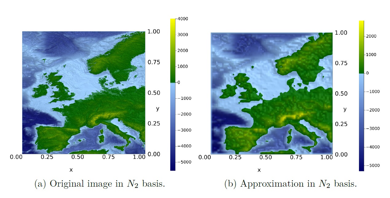
Wavelet-based image compression offers a way to reduce large topographic datasets while preserving the terrain information needed for archaeological least-cost path analysis. By combining multiresolution approximation with graph-based routing, the study shows how more realistic paths between archaeological sites can be computed while substantially reducing computational effort.
Read Lena’s Bachelor’s thesis here: 10.13140/RG.2.2.18192.16648