We investigate how to identify possible migration routes of humans in the past represented in networks. Humans’ presence likely spanned large parts of Europe since the last glacial maximum (LGM). While most migratory events on a small scale would have ebbed and flowed based on external factors, major migratory events are modelled using migration corridors between a map of human presence sites based on archaeological data.
We use datasets like from the CRC 806 “Our Way to Europe” Project [CRC ] as the base dataset of human presence. This dataset contains 485 entries of archaeological data spanned across Europe, which can be extended using data from time periods until the mid holocene. This can be understood as the baseline of human presence, which are to be connected via migration corridors. The archaeological data is interpreted as nodes of a network. The connections via migration routes are the edges of a network. The essential task is to determine which nodes should be connected.
In the absence of other information on connectivity, the distance between nodes of the network is used as the prime factor of possible connectivity. In essence, I propose a model of connectivity with higher probability the smaller the distance between the nodes is. The underlying probability in the deciding rule means that the resulting network will be a stochastic network. The robustness of the network can be tested using eigenvalue methods. So far we have discussed a decision rule based on distance.
The calculation of distance is based on a notion of effective distance. An effective distance approach would mimic migration corridors the most, as humans would have to base their migration on a relation of distance to effort required. In order to determine the effective distance I, together with Lena Perlberg, research assistant at HESCOR, calculate a least cost path based on Dijkstra’s algorithm applied to a cost map [Kon]. The cost map is mainly determined by topographical data. We plan to enhance the cost map using more cost layers like vegetation or waterways. Dijkstra’s algorithm then determines a least cost path by exploring the entire cost map and determining the lowest accumulated cost between two points. This least cost path is determined between each pair of nodes. Afterwards, the decision making process based on probability is applied. After the application of all concepts, we can create networks that describe a network of possible migration routes of humans in the past.
Eventually the networks created are going to be used to model the migration of humans since the LGM using a differential equation model using a diffusion-advection-type partial differential equations on metric graphs. The methods described above are used to create the networks, which can then be translated into a metric graph.
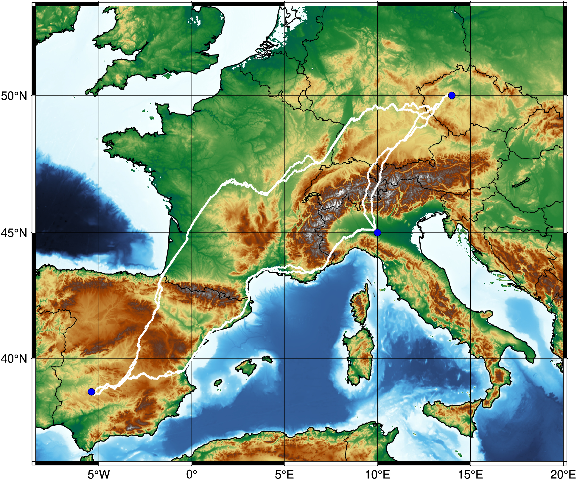
Visualization of the least-cost path between three points, calculated using Dijkstra’s algorithm. The route successfully circumvents major topographical obstacles like the Alps and the Pyrenees, while also finding optimal passages through the mountains where necessary. (copyright: Lena Perlberg).
[CRC] I. Schmidt, CRC806_E1_AUR_Sites_Database_20210331. CRC806-Database, University of Cologne, 2021, DOI: 10.5880/SFB806.63.
[Kon] Y. Kondo et al., „Ecological Niche and Least-Cost Path Analyses to Estimate Optimal Migration Routes of Initial Upper Palaeolithic Populations to Eurasia“, In: The Middle and Upper Paleolithic Archeology of the Levant and Beyond, pp. 199-212, Springer, 2018.
[PB] L. Perlberg, M. Brockmann, Creating migration networks based on archaeological data using least-cost-path analysis, Poster, Rhein-Ruhr-Workshop, January 2025, DOI: 10.5880/SFB806.63.2